Thursday, July 28, 2016

More photos of the bike trip from Pat's camera.


Relaxing on the beach in Oregon near our first campsite.

Chickens at the Airbnb in Eugene, Oregon. We got fresh eggs every morning.


Coming out of Sisters Oregon.

More views from Sisters, Oregon. At least two of these mountains are sisters. I think that the third sister is hiding.


While we still had the car, Sherry drove us to the Painted Hills in Oregon.


Prineville? Dayville? Prairie City?


Fresh water by the side of the road near the completely empty Bates State Park. A bartender told us about this spring. It was near the exit that she used to meet her ex-husband to exchange their daughter.


 Waiting for Tom to arrive in Baker City, Oregon - we went to the movies to see X-Men Apocalypse. One seriously stinky turd of a movie, but there aren't many movie choices in small towns. Either the latest Disney kid movie, or the latest action movie.


Tom's 26 year old Novara touring bike, all loaded up.

Somewhere in Eastern Oregon.


 Yes, his thermometer says 108 degrees.


A hammock is a lovely accessory for bike camping.


Ever little town has a post office. Some of them are little more than a construction trailer with an American flag outside. Tom mailed home a lot of his unnecessary gear from Lucile.


The Swiftwater RV park near White Bird, Idaho. Nice neighbors, a shower, cold water, and a lovely river to camp next to.


At the top of the White Bird pass. Lots of elevation gain, but a relatively low grade, so we just pedaled and slowly made it up.


Temporary flatness heading out of Grangeville, until we hit our steepest downhill of the trip. Probably 2 miles of 16%. We each hit over 40 mph and could smell our brake pads.


Our lovely hotel-mates in Kooskia, Idaho. The passenger flashed her Glock as she was unpacking, just so we would know.


Sign says "Winding Road Next 99 Miles" and they meant it. We are on Rte 12 in Idaho following the Clearwater River and the Lochsa River for the next 99 miles. There were no services at all along this stretch. Not a single gas station, hotel or convenience store.

Pat, entering Montana. We had just gone over Lolo pass.


Missoula is the headquarters for the Adventure Bicycling Association, and any rider who comes through can get a polaroid pinned to the wall. This is Pat's.


Pat, wearing every piece of clothing he has and getting ready for the downhill. It snowed on us coming over this pass and the downhill was really cold.

More mountains and barbed wire.


Mooo - Wyoming is cattle country


At Quake Lake, this entire hillside slid down into a river and created a large lake behind it, and killed quite a few people in the process. Parts of the hillside ran all the way up the other side of the valley.


Coming into Yellowstone at the West Yellowstone entrance.


Cooking something in Grant Village, Yellowstone


Taking a break from the RV's and the Harleys in Yellowstone.


The local meat shop in Dubois provided the Italian sausage for our pasta sauce, cooked in the church kitchen.


Lots of antlers around here.  We took a rest day in Dubois and just wandered around the town.


The church in Dubois where we spent one night.


A dramatic shot of the run-down church in Jeffry City


Melt some butter, brown the pecans in the butter, add some bourbon and stand back to let them flame, pour in some real maple syrup and wait for it to come to a boil and then add the thinly sliced banana. Let it cool a little while the french toast is cooking. Serve, eat, be happy.


Lots of cracks in the Wyoming roads, many of them leading in the direction of travel. They were pretty wide and seemed to be filled with black marshmallow goop. Best not to get your wheels in them.

The Beaver Creek fires in the distance, coming into Riverside, Wyoming


Chili a-la-Pat in Riversideside, Wyoming.


Enjoying the chili.


Another view of the Beaver Creek fires, still burning mostly uncontained. On the road from Riverside to Walden


The pie shop in Granby, Colorado - we ate half for dessert and half for breakfast. It was a drive-up shop but we just walked.

Wednesday, July 20, 2016

Article for the Neighborhood Newsletter About the Bike Trip.

This is an article we wrote for our neighborhood newsletter about our 6-week bike trip from Astoria to Boulder. Plenty of photos here:  https://goo.gl/photos/knBhHC23uTsVmFhR7

Who: Pat White of 3315 Elm Terrace and Mike Evanoff of 3319 Elm Terrace
What: 6-week bicycle tour from Astoria, Oregon to Boulder, Colorado with a total of 2270 miles of riding.
When: 23 May through 4 July


40 years ago, in 1976, a group called “Bike-centennial” rode bikes across the USA to help celebrate the Bi-centennial. We both remember that adventure and have wanted to ride the route ever since. Bike-centennial is now the “Adventure Cycling Association” but the route has remained and has been refined over the years. If you Google “transamerica bicycle trail”, the first hit will be the route we rode. The route is over 4000 miles, and generally takes about 10-12 weeks to ride. Since we could only take six weeks off to do the ride, and we did not want to try to rush across the country, we decided on riding only the western half this year. We wanted to visit the sites, talk to the locals, soak in the hot springs and generally go at a pace that would allow us to drink in the experience. The eastern part of the route will have to wait for another year.


We are both long-time bicycle commuters, riding back and forth to work to avoid traffic and to stay in shape. However, Pat had never been bicycle touring and Mike’s experience was limited to a few trips in college and a 10-day trip last summer. Pat had not slept in a tent for more than 20 years. Clearly, this was a big and uncertain undertaking for two novice bike tourists.
Mike and Sherry went first to Washington State to visit Mike’s parents and then picked up Pat in Portland to start the ride in Astoria, Oregon. We had already shipped our bikes to a local bike shop in Astoria, so our first order of business was to pick them up and put them together. Once we started riding, Sherry shadowed us in the rental car for about 7 days, which made for a nice easy first week because we just threw the bags into the car and could ride unloaded. Sherry would get to the campsites and have cold beer ready for us on arrival. When Sherry left us near John Day, Oregon, we were all alone for the first time. Kicked out of the nest and having to fend for ourselves.


Everything we needed was on the bikes. We each carried a tent, sleeping bag and sleeping pad and we shared the group gear which was mostly cooking equipment. We camped most nights, but stayed in roadside hotels or cabins when the mood hit, or when there was no good camping option. Several towns would allow people to camp in the city park for free, and several churches allowed bike riders to sleep in their basement or social halls. Otherwise, commercial campgrounds and RV parks generally had some form of tent camping option. The beautiful thing about bike touring is that you pass grocery stores and liquor stores on a daily basis. No freeze-dried camp food or instant oatmeal for us. We had eggs and grits or french toast for breakfast, and our dinners ranged from stir fry to pasta sauces with locally grown sausage to big fat chunks of salmon. We were the travelling gourmets. It is amazing what you can do with a propane burner and an Ace Hardware frying pan. A lot of the small towns in the west have a local meat shop because there are so many cows and ranches. We had really nice grass fed beef, some lovely pork loin and the best beef jerky that either of us had ever had. Many hours on the bike were spent daydreaming about what we would cook for dinner that night.


The bikes held up really well - we each had one flat tire and that's about it. We oiled our chains and kept the tires mostly pumped up and suffered no mechanical issues of any significance. Other than Mike pitching his tent on top of a very powerful sprinkler head, and realizing his mistake when the sprinkler came on at midnight, we didn’t have any real disasters in camp, either. Since we were on the most popular bike touring route in the country, there were usually other cyclists in the campground with us. We had a small brotherhood of lunatics wherever we went! While most bike tourists seem to be men between 55 and 65, there were a number of younger people, several couples, lots of Dutch people and one young couple who were too beautiful to be roughing it, yet here they were. Bicycle touring is physically demanding, but if you go slow, and just keep moving, even marginally  fit people seem to be able to complete the distance. We rode about 60 miles per day and then took a few rest days inbetween riding days, and every day was a challenge in some way.  In the end, between the uphills and the headwinds, we each lost about 10 pounds.


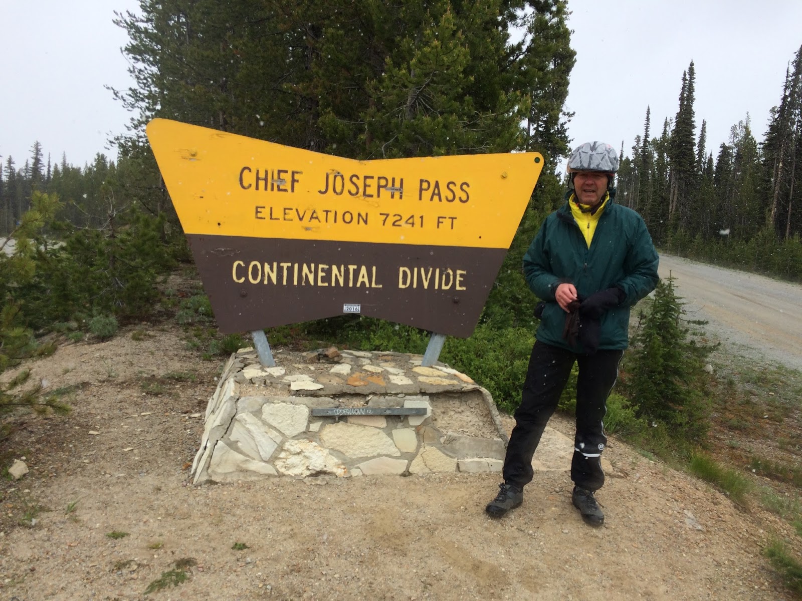
A typical day started with one of us getting out of the tent and making fresh drip coffee - Pat’s black and Mike’s with half-and-half, often a collection of little containers liberated from a diner. Next we made breakfast while packing tents and sleeping bags, or we just went to a diner if we thought there would be one within the first 20 miles down the road. Most days we would also incorporate a breakfast beer at the top of the first climb, or just some time before the beer started to get warm. Mike, the organized one, would leave camp a little before Pat, but would get caught pretty quickly. We would typically stop at each small town we passed if nothing more than to fill up water bottles or buy a snack. Lunch would last from 9am until 3pm and consisted mostly finger food in the handlebar bag. We were both partial to Fig Newtons, Mounds bars, bananas, and PB&J sandwiches. We were riding about 60 miles per day, and had an average pace of about 12 mph, so each day saw about 5 hours of turning pedals. Sounds like a lot, but we broke it up with rests, small towns and the occasional swim break. During the day, we each spent some time daydreaming about what to have for dinner, and we planned the day’s ride around where to shop for food. We had a lunchbox style cooler that would fit a six-pack, some ice, and a few other cold items, and we packed the rest of the food into whatever space we had in our bags. Finally, we would roll into our destination town and find the park or the RV site or a church or a hotel and settle in for the night. We stayed in hotels or cabins a little more than we had first anticipated because Mike was sick for about two weeks from Missoula until late into Wyoming and a good night’s sleep helps considerably.  We had record high temperatures in eastern Oregon and Idaho, we had unseasonably cold weather in parts of Montana (we got snowed on going over one of the passes) and the winds in Wyoming are not to be underestimated. The only thing we mostly avoided was rain. There really was no typical day, because each day had a challenge built into it somewhere.


Since we are both social and inquisitive, we interacted quite a bit with the locals in the towns along the route. We were both surprised at the entirely different way that “Westerners” view the country relative to our eastern views. Since our trip was more of a journey than a destination, we went to the museums, read the roadside history signs, and generally took our time. Mike was constantly chatting up people we met in restaurants, on sidewalks and by the side of the road.  In Baker City, OR, after talking to a couple with a beautiful tandem bicycle, telling them about our tour and geeking out over their cycling equipment, Mike was told about a couple in Halfway, Oregon named Whitey and Katie who might put us up for the night. Whitey said to come ahead (“look for the green dormers, that’ll be us”) and suggested they’d feed us as well.  


Whitey and Katie welcomed us, told us to put our bikes in the barn, and then showed us to our private bunkhouse rooms.  They explained that they had built the bunkhouse for their visiting sons and daughter and grandkids.  After we’d showered and had a couple of beers, we got better acquainted on the front porch and they began to make an amazing spread, including homemade hamburger buns (!) and a chocolate peanutbutter dessert.  


After dinner, Whitey and their dog walked us around their property and we met llamas, who have the personalities of lawn furniture, but with amazing deep dark brown softball-sized eyes.  He told us about taking pictures of the wildlife that is all around them, but seldom seen, except with his motion-detector camera, and was quite proud of the mountain lion he had photographed.  Walking through what had been an orchard, we saw at the edge of their property a big animal with its head thrust up into an apple tree.  At first we thought it was a deer, and as we startled it and it bounded into the woods, realized it was an elk, probably female.  


As a kid I remember reading about how hobos network and even leave symbols at individual houses where the family was welcoming (or not) and willing to give food or share food in exchange for work.  The cycle touring network functions in much the same way, and during our eastward ride we were constantly talking with westbound cyclists and exchanging intel about church basements, campgrounds and the availability of groceries (and beer) at our next waypoint.  So we learned that the Baptist Church in Jeffrey City would let cyclists overnight in the basement, that there was no water or retail or anything in Lamont, and that Lander had a great city park that allowed overnight camping.  We also fell into shifting cohorts of riders on our eastbound route.  “Ohio Mike” was a grizzled retired mechanical engineer who grew up on a farm in Iowa, was going to ride to Muddy Gap and then head for Iowa’s famous Ragbrai Ride to meet up with this daughter, loved to poke fun at Pat for having boiled our only pot dry on the camp stove and destroying it, and explained that his wife let him tour on his bicycle so that he wouldn’t get tattoos.  Ron and Marion.  Marcia and Husband.  Tom and Katie.  Bart and Ian.  John and his third attempt.  


I think that we were both surprised at what environmental disasters had been inflicted on the west. Most of Montana is treeless because of clearcutting around 1900 and then the overgrazing by cattle and sheep. Many of the towns, including Missoula, had mining operations that dumped all manner of toxins and heavy metals into the rivers, and the cleanup did not even begin until the 1960’s. Gold mining has left many stream beds completely ruined with endless mounds of tailings. There was a period where timber and mineral extraction was carried out on large scales without any concern for the environment or sustainability. I think that the east had similar treatment, but more years have passed to allow the land to heal. In the west, it is still quite apparent and the scars are fresh. Many of the small towns that we passed through had been timber or mining towns, but now the population is in the hundreds (or dozens), not the thousands that used to be there. These towns are dying or barely clinging to life with no apparent economic miracle on the horizon.

For a couple of middle-aged east-coast city boys, this trip was enlightening, difficult, awe inspiring, completely outside of our comfort zones, thrilling, crushing and, in the end, a real journey. We each have a different appreciation for the people and the landscapes that we passed through, and for our own abilities to travel through them.

Missoula to Boulder


Heading out of Missoula, we rode along the Bitterroot mountains for about 40 miles.

There is a dedicated bike path for 40 miles or so heading out of Missoula. A real treat to be separated from traffic for such a long time.


 We left Darby, Montana in the morning with a nice light tailwind and good weather. It did not last. Pretty soon, we had ugly headwinds and rain. We had to climb Chief Joseph Pass that day, and it was raining most of the way up the pass until it started snowing. At the top, it was windy and sleeting. About 5 bicyclists were huddled in the men's room at the summit rest area, hitting the hand dryers to warm up the place. I made and ate chicken noodle soup on the floor of the men's room. After that, I put on every piece of clothing and rain gear that I had and started the descent. The next morning in Wisdom, Montana, we bought hats and gloves.


 Every restaurant and bar in the west has stuffed heads in it. This one is in Wisdom, Montana.


Wisdom is located in the "Big Hole" area of Montana. A very large plain surrounded by mountains. The morning ride was lovely until the weather and winds moved in. Big Hole Pass nearly killed me. I was still pretty sick, and we had about 15 miles of strong headwinds coming up to the pass, and the winds were blowing straight at us from the pass. It was only about an 800 foot climb, but I had to walk several times.


Fresh snow on the mountain tops today. The past two days have been gruelling with rain, snow, fierce headwinds and lots of hills. Today, though, has been awesome. Warmer weather, 27 miles of strong tailwinds to get rolling this morning and even the occasional ray of sunshine.


Aquavit Gimlets by the teepee. Glamping in style. Pat bought a bottle of local aquavit at the distillery in Missoula, so we got limes and added sugar and/or maple syrup to make the gimlets. Most campgrounds had ice available for a few dollars a bag, so we could keep our beer cold and have ice for cocktail hour. 


Typical denuded hills in Montana. Most of the hills we rode past were stripped of trees around 1900 and then overgrazed, leaving them barren 100 years later.


Halfway down a lovely downhill leading into Ennis, Montana. The sign is sponsored by the cattle association, and they talk about how the ranchers and the grazing cattle keep the land "open for wildlife". What we mostly saw were birds and panicked pronghorn running along the barbed wire fences. We had to wait to get into un-fenced Yellowstone to see any actual wildlife.


More mountains in Montana.


Barbed wire fences and mountains are the two defining features of Montana. Miles and miles of both have been our companions for days.


Typical riding conditions on the larger roads in Montana and Wyoming. A large shoulder with rumble strips.

Typical riding conditions for the smaller roads. Just a shoulder that is 2-3 feet wide. Safe enough for lightly traveled roads. We each had a highly visible rear flasher that we would run during the days.


We went past "Quake Lake" which was formed in 1959 when an earthquake caused a landslide that blocked a river.  About 30 people died because the area was a popular camping destination.


In West Yellowstone, getting ready to enter the park. West Yellowstone is a tourist hell, but they did have a place to buy the propane cannister that we needed, and had a beer store and, of course, the Taco Bus. An old bus with the kitchen in the back. We ordered two burritos because they would survive a 20-mile ride to the campsite in our handlebar bags.


This is the lodge at Old Faithful. A huge and historic wooden building.


One of our many crossings of the Continental Divide.


It seemed like we were crossing the Continental Divide over and over again. The map below shows our route in yellow and the divide in red.


One day in Yellowstone, we crossed it three times!


 Not a lot of oxygen up here. I used to be sucking wind at 5000 feet, now I'm sucking it at 8000. Progress? Hard to tell.


We came across a number of "bikepackers" who were riding the Continental Divide Trail, which is mostly jeep trails and dirt roads. They have mountain bikes with a minimal amount of gear packed into smaller bags distributed around the bike. These bags don't jump around or fall off when the bike hits big bumps. They also work on bikes with front and rear suspension.


Goodbye Yellowstone, hello Tetons. We exited Yellowstone today and rode south into the Tetons. I've had zero connectivity for the past few days but just found some wifi in a cafe.

Yellowstone is an RV and Harley fest. Incredibly loud or extremely close. The speed limits are low and there was enough shoulder but still. Extreme consumerism in a spectacular locale.


 Getting a little tired of the campsite thing so we left our tents set up in the camp and came down to the lake to sleep. We are the only ones here. No car alarms or dogs or diesels.


We are about to start our really long climb out of the Teton Valley up and over a 9500 foot pass. I had to keep stopping to look back at the Tetons because they are so iconic and dramatic. Very new mountains made from very old rock.

 The little brown blob behind the tail light is a grizzly. I saw this truck pass me and start to do a u turn just as I looked left to see the bear. I was happy to have the truck pull up between me and the grizzly. Pretty cool to see one relatively close and in the wild.


Wyoming has a lot of scenic rock formations.


 Taking a day off in Dubois Wyoming. Good time to lube the chains, true the wheels and check the tires for glass. So far, we have only had one flat tire between the two of us.


Yup, the pot is dead. Pat left it on the stove for about 15 minutes while the stove was still on. Way beyond the design specs for a collapsible pot. We ended up getting a replacement for $3 at the local thrift shop. Stainless Steel this time, not silicone rubber.


 Some southwest-looking red rock formations along the road.


Pat dropped his iPhone in Wyoming. He bought some tape and did a field repair that lasted the rest of the trip.

A lot of the town's we pass through allow camping in the city park. The park in Lander Wyoming has set the gold standard. Big shade trees, nicely mowed green grass, and some little creeks running through.


You can just see the last of the Bitterroots in the background


Sometimes bike touring is all romance and glamor. Other times it is just hard and exhausting. Today was the latter. Wind, hills and lousy pavement. You can see the flags trying to rip themselves from the pole. Wyoming is like this. Always wind from somewhere.


Even the church steeple can't compete with the wind in Wyoming. We stayed in the basement of this church one night. Not much else in Jeffrey City.


The church basement. There were a few little bedrooms and a kitchen. Two of the bedrooms had mattresses in them - the kind of mattress you would find a dead junkie on. Whatever. We used them anyway.


We had to ride on the Interstate in Wyoming for about 15 miles. Safe, but loud and tedious.


Smoke from the Beaver Creek fire in Colorado. We are heading that way tomorrow but the cyclists coming from that direction are reporting no problems. Taking a day off today to rest and relax.


Moscow Mules in the campsite using Fever Tree ginger beer, just like the New York Times recommends.


 Made it to Colorado. Wyoming did not want us to leave. Strong headwinds all day and the smoke from the Beaver Creek fires blowing in our direction. Despite all that, we escaped!


The city park in Walden, Colorado. There were about 5 biker groups in this campsite tonight, and it is right next to the high school where the entire state and federal firefighting team is headquartered for fighting the Beaver Creek fires.


Mike's camping tip #1- do not set up your tent with one of these high pressure sprinklers located in-between your tent and your rain fly. Unless, of course, you really need a midnight shower and a good cleaning of all of your gear. I had about a gallon of water sloshing around in the bottom of the tent when this thing went off. I had to use my panniers to block the spray while I moved and shook out my tent and rearranged my gear. 


 You can see storms coming from a long way off here in Big Sky Country. In Virginia, they just hit out of nowhere.


This is our last campsite of the trip. Today, Pat's wife meets us in Breckenridge and then we wander our way to Boulder, taking advantage of hotels and the rental car for our last two days of riding.

It has been overcast, moody and rainy for the past two days and we are mostly wet and dirty. Tonight we get a real shower and possibly a washing machine.


Mike and a friend on the road to Breckenridge.


Leaving Breckenridge, heading for Idaho Springs. We are no longer on the Adventure Cycling maps so we don't really know what kind of hills are facing us for the day. This one was a surprise.


Fresh Salmon on the grill.


Fixing the only flat tire I had on the entire trip.

Bar stools with built-in weaponry.


Finally, it is clearing up in Colorado. Spent last night in Breckenridge, a tourist nightmare. Today, we are riding without bags past Keystone and Arapaho Basin up and over Loveland Pass at 11990 feet. I'm planning to find a 10 foot hill so I can be over 12000 feet.


A snowbank on the way up to Loveland Pass.


11990 feet - highest pass of the trip. Highest pass of my life (on bikes). We had a 4500 foot, 30 mile downhill after the pass. Tomorrow, we roll into Boulder and the bike riding is over. Sherry arrives into Boulder tomorrow and we have an airbnb for a week there.


In Boulder!

I have hiked around the Flatirons several times in the past, bit never actually hiked all the way to the top. There were time limits or we didn't have good shoes or water bottles. Today, I had shoes, water and time. They look monolithic from town, but they are complex and diverse close-up. Flatiron #1 is in the background of the selfie, and Flatiron #3 is in the other photo.


One thing we really like about Boulder is that many of the houses have outdoor living areas with come couches or chairs. It hardly ever rains, and the humidity is low, so we find ourselves living mostly outside. If you are in the shade, even 90 degrees seems pleasant. This photo is from our second Airbnb rental. The first one had a similar space to lounge in.


Sherry on a hike with the Flatirons in the background.