I flew to Manchester, England and met up with Robert Livezy and Dave Green to hike the Pennine Way. The entire hike is about 240 miles, and I did all but the last two days because I had to go meet Sherry so we could hike coast-to-coast in the UK.
These are just a subset of the photos available. All of the photos that I took and that I stole from others are available in an album at this link.
George Mason t-shirt and a backpack! I had my last set of final exams on Monday and it seems that I passed them all. I now have a BA in Spanish and I'm off to hike two of the British national trails. First, the Pennine Way with Robert Livezey and then the Coast to Coast with Sherry McRoberts Evanoff. I expect a lot of rain offset by cozy pubs.

Rocks,moors and sheep. Lots of sheep. The lambs are very cute. 15 miles or so today from Edale to Crowden on the Pennine Way.

Full English breakfast followed by full English weather. 50 degrees, windy and rainy most of the day. We stayed warm and dry enough until we made the mistake of taking a shortcut through a bog. It seems that you can take your socks out of the bog, but you can't take the bog out of your socks. They will be tea colored forever more.


After four days of hard hiking in northern England, I'm ready for my Game of Thrones audition.

The ever changing face of the Pennine Way
Sometimes people ask about the trail conditions and the condition of the path itself. Here are photos looking down at the trail. Everything from old possibly Roman cobblestone roads to nothing more than a part of the grass that is a little more trampled than the surroundings. The photo with two hikers in it was a section of trail where the farmer had just cut the long grass and we were slogging through it. Plenty of muddy bits and rocky sections. The big rock slabs are placed in the boggy parts of the moors. They are taken from the old factory floors where the cotton and wool mills operated.


I wouldn't want people to think that we are actually "roughing it" on our hike. To that end, here is the view from the breakfast table where I am sipping my coffee and waiting for my freshly prepared breakfast.

The three survivors
All of the areas that we have hiked through are completely deforested and badly overgrazed. Aside from closely cropped grass, the only things that survive are plants that sheep don't eat. Here are three of the most prolific survivors. An abundant reed-like plant, really vicious thistles and stinging nettle. It is hard to avoid the last two when hiking and sitting. The nettle are particularly prevalent along the trail and really irritating.


Lunch, UK style. A pork meat pie. I would try to describe it, but I am at a loss for words.

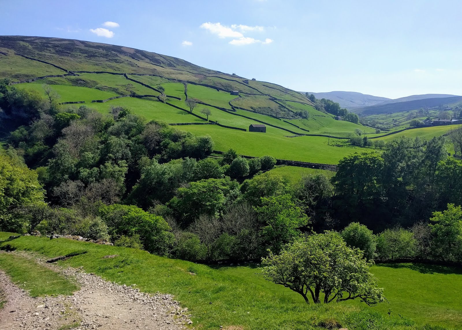
Green yellow and blue
I know that England is supposed to be green but the valley where Keld is located is ridiculous. Also, the Bluebells are out and a lot of yellow wildflowers are in the fields.
Waterfalls, rivers and glaciers today
We started out the day along a river with two waterfalls, Low Force and High Force. They look like they are full of iced tea because of all of the tannins in the peat bogs. We followed the river and it's tributaries for almost 12 miles, through some pretty rocky spots. Finally, we reached the highlight of the day, which was a large glacial valley around the 17 mile marker. The long drop into the village of Dufton somehow led us right to a pub.


Pennine Way, Day 10:
Great weather, 20 miles, over 12 along the River Tees and its 3 waterfalls with evocative names, then on to the magnificent, glacier-carved High Cup. Tomorrow is the crux of the Pennine Way in terms of millage and ascent. Unfortunately the weather forecast is not good.

Mike's navigation system
I pull the pages out of the guide book for today's hike and put them into a Ziploc bag. This gets me through about 95 percent of my navigational needs. The other 5 percent involves pulling out the compass when I am just a little bit off track and alone in the fog and rain or the nuclear option of using the GPS app on my phone when I reach the end of an expansive cow field with multiple criss cross tracks and have absolutely no idea where I ended up.
Today was a huge 24 mile day with no compass and one GPS bail out.

Done with the Pennine Way,
I'm off to London to meet Sherry McRoberts Evanoff before we embark on the Coast to Coast hike from St Bees to Robin Hoods Bay. I am sporting a full 2 week growth and I feel as tired as I look.
(Nothing is wrong with my forehead. It is just the lighting)

No comments:
Post a Comment